| Author | Amna Azeem |
|---|---|
| Title | Geo-visualization of Child-Friendly Urban Mobility: Design and Implementation of a Visualization Tool |
| Programme | Copernicus Master in Digital Earth (Erasmus Mundus EMJMD) |
| Supervisor, UPOL | Dr. Vít Vozénílek |
| Supervisor, PLUS | Dr. Martin Loidl |
| Institutions | Palacký University Olomouc & Paris Lodron University Salzburg |
| Research Collaboration | Mobility Lab Salzburg & i-MOBYL |
| Year | 2026 |
Background
NetAScore and Child-Friendly Mobility
NetAScore is an open-source framework developed to assess the walkability and bikeability of street networks using spatial data. By combining attributes such as pedestrian infrastructure, road category and traffic speed, it generates segment-level scores that reveal how suitable streets are for active transport. However, existing implementations of NetAScore were designed around adult travel needs. Children experience streets very differently: their lower height, developing road awareness, sensitivity to traffic speed, preference for perceived-safe routes, and need for play all shape how they navigate urban space. This thesis addresses that gap.






Framework Adaptation
The original NetAScore scoring weights were reviewed and modified to reflect factors most relevant to children: safety, comfort, inspiration and play.
Participatory Workshops
Workshops with pupils at Salis International School in Salzburg revealing interesting insights such as the need for colours, play or motivation to walk and bike.
Spatial Data Integration
OpenStreetMap network data for Salzburg was processed and enriched with local datasets. Participatory insights calibrated the child-specific scoring model.
Geovisualization Dashboard
An interactive dashboard presents walkability and bikeability scores spatially, enabling planners to assess the suitability of road segments for young adolescents.
Results
Road Suitability Scores
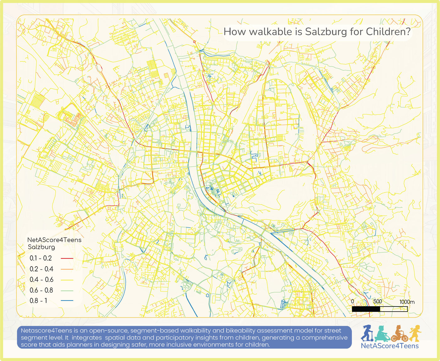
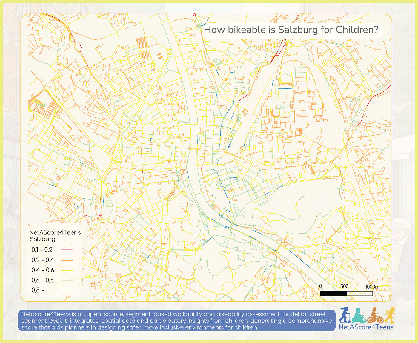
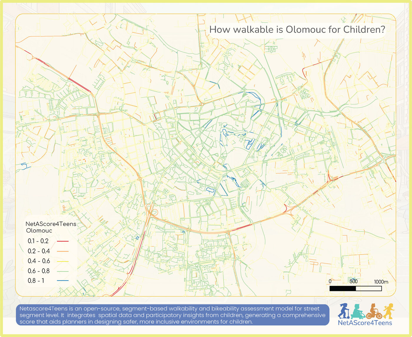
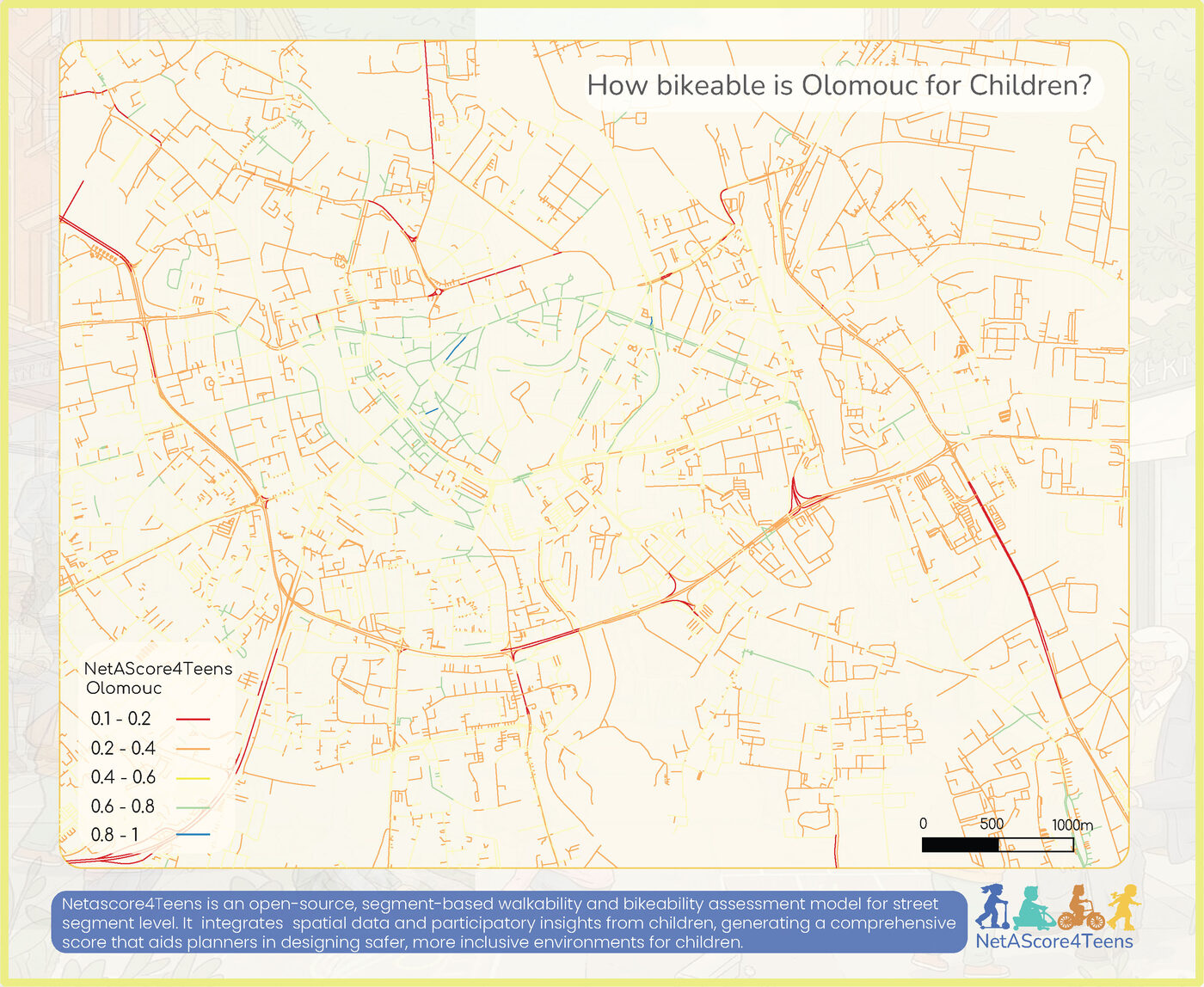
The NetAScore4Teens model generates a road suitability score for each street segment in the case study area, visualized across five categories: Poor (0–0.2), Average (0.2–0.4), Moderate (0.4–0.6), Good (0.6–0.8), Excellent (0.8–1).